Cork County Historic Town and Archaeological Maps
The Cork County Council Heritage Section has developed a series of Historic Town Maps for 14 towns and villages in Cork County. Initially a West Cork initiative with 8 maps produced for that region, the project has expanded to include the production of Historic Town Maps for the towns of Charleville and Mitchelstown, with plans to produce additional maps for other historic towns around the County.
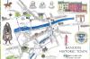
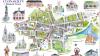
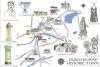
The maps are designed to be a self-guided tour of the town’s key heritage sites. Each one contains beautiful illustrations of the key sites and buildings and a brief history. They are part of a strategy by Cork County Council to highlight the rich heritage resource to be seen in our towns and villages in County Cork.
Document Summary
Document Summary
Visitor
06 Apr 2022
pdf
3.65MB
Bandon (pdf)
Visitor
06 Apr 2022
pdf
2.16MB
Bantry (pdf)
Visitor
06 Apr 2022
pdf
2.30MB
Castletownbere (pdf)
Visitor
06 Apr 2022
pdf
2.23MB
Charleville (pdf)
Visitor
06 Apr 2022
pdf
1.27MB
Clonakilty (pdf)
Visitor
01 Sep 2023
pdf
4.86MB
Cobh (pdf)
Visitor
06 Apr 2022
pdf
2.97MB
Dunmanway (pdf)
Visitor
20 Apr 2023
pdf
2.48MB
Fermoy (pdf)
Visitor
31 Jan 2024
pdf
2.35MB
Kanturk (pdf)
Visitor
06 Apr 2022
pdf
2.31MB
Kinsale (pdf)
Visitor
06 Jul 2022
pdf
4.54MB
Macroom (pdf)
Visitor
08 May 2023
pdf
2.88MB
Mallow (pdf)
Visitor
06 Jul 2022
pdf
3.17MB
Millstreet (pdf)
Visitor
06 Apr 2022
pdf
971.78KB
Mitchelstown (pdf)
Visitor
06 Apr 2022
pdf
969.57KB
Schull (pdf)
Visitor
06 Apr 2022
pdf
2.15MB
Skibbereen (pdf)
Visitor
04 Jan 2023
pdf
2.58MB
Youghal (pdf)
Visitor
15 May 2023
pdf
4.20MB
One hundred and one archaeological sites in West Cork (pdf)
Visitor
20 Jul 2023
pdf
6.17MB
One hundred and one archaeological sites in North and East Cork (pdf)